The first place we went to was Saida. There was another crusader castle:


ArcSoft has sent me a cease-and-desist letter regarding the mentioning of a certain photo-combining software, sooo... some large pictures:


After the castle, we walked around Saida's markets and went in this thing:

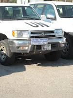
After Saida, we went to Tyre. Once we got off the highway, we had to go through a UN checkpoint- my first. Southern Lebanon is where a lot of the fighting took place between Hezbollah and Israel a few years ago, the UN peacekeeping force is a result of this and a few other conflicts that have happened in the region.
The white, UN APCs:

..also, the yellow flag above the KFC advertisement is a Hezbollah flag
 After the checkpoint, the road went through citrus groves with Hezbollah flags and signs lining the street:
 Various Hezbollah leaders:
As mentioned, Hezbollah and Amal are apart of the coalition representing the opposition. On the left, Hasan Nasrallah, the leader of Hezbollah, and on the right, Nabih Berri, the leader of Amal and current speaker of the Parliament:

We drove through Tyre, saw some more UN patrols and election signs. Then we went to a Roman ruins site:


 At the time, I thought we were right on the border with Israel and so I took this photo thinking it was Israel. Later, I looked at a map and realized we were not that close.
 ..so yeah, this just a photo of a random town in Lebanon


HUGE KFC! 2 stories + a rooftop dining area!

I am pretty sure this is just a 'don't forget to vote' sort of sign:

A sign for the Amal Movement. Amal is an ackronym for 'hope'

Heading to the town of Qana, another Amal sign:

This is a picture of Imad Mughniyah, a founding member of Hezbollah and was considered head of security for the group. He has been tied to a number of attacks, including the bombing of the US Marine barracks in Beirut in 1982 and the US Embassy bombing in 1983. He was on the US Most Wanted Terrorist List with a $5 million bounty, until he was killed by a car bomb in Damascus in February of last year.
 Soo yes, we were going to Qana, where it is thought that Jesus performed the wine-into-water miracle.
There was a nice little building by the path that takes you to a cave where it may have gone down:

"Is this it?"

 There were people-like figures carved into the rocks. I want to say they were supposed to be the 12 diciples and Jesus, but that may not be right:
 Qana scenery:


Mughniyah and Nasrallah:

We came back through Thyre from Qana and went to another ruins site. We could not find the main entrance, but we found a gap in the fence, so went through that..
 There was a large hippodrome among other random ruins..
The ruins were next to a Palestinian refugee camp. You can see some of the housing in this photo


After the ruins, we decided that we needed another huge Lebanese meal. Our driver called a friend and asked what was good in Thyre. We ended up going to a hotel..
..where the UN was based/staying, apparently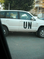
 A unit of French UN soldiers were eating there, too. Darren and Jess with the unit in the background:

In the parking lot, this car had a Hasan Nasrallah air freshner- seriously: ..it's good marketing
In hindsight, it may not have been a good idea to eat where the UN was eating....
On our way out, we drove by another UN patrol

 A unit of French UN soldiers were eating there, too. Darren and Jess with the unit in the background:
In the parking lot, this car had a Hasan Nasrallah air freshner- seriously:
 ..it's good marketing
In hindsight, it may not have been a good idea to eat where the UN was eating....
On our way out, we drove by another UN patrol

We passed by what I think was the Amal headquarters. It was a large compound with Amal flags surrounding it and there was a strong UN presence there.


 One thing I noticed, but did not get a picture of was this missile-looking object that was suspended, but pointing toward the ground. Around it were several Hezbollah signs. I assume it is marking a location where an Israeli artillery shell/bomb/missile landed. What I do not know and am curious about is if Hezbollah put it up as a reminder of 2006 and how they took on Israel, like a campaign prop, or if the markers are all over the place, at all times. I managed to get a picture of another one we drove by. It was bomb-shaped, instead of missile-shaped and had another Hezbollah sign behind it. It is hard to see in the picture, but it is that black thing on a pole to the left of the center:
 A sign at the UN checkpoint about the use of cluster bombs
I think we just relaxed afterward..


